
Vikings, Saints & Chieftains walked this.

All 18 miles of it!
We’re walking from the Hill of the O'Neill (Castle Hill, Dungannon) to Navan Fort in Armagh, all 18 miles of it! Not that boring main road but the ancient route used for thousands of years by Saints, settlers, traders, Vikings & Chieftains.
Accessibility
The Big foot walk is open to walkers of all abilities including wheelchair users. However, this is a very challenging walk with occasional steep sloping gradients and uneven surfaces, especially in the second half of the course. The route covers main roads with footpaths, minor roads with no footpaths, country lanes, forest paths and river bank trails. The route may prove challenging for some walkers with ambulant disabilities and wheelchair users (without assistant support). Please contact us well in advance if you require support vehicles, including wheelchair accessible vans, alternative routes, including distances and starting positions.
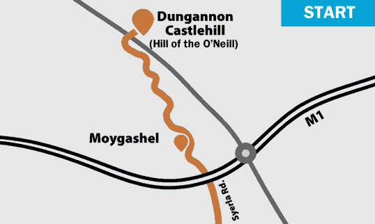
Parking is available in Dungannon Square. Registration is at the The Hill of the O'Neill (Ranfurly House), from 9.00am. Pick up your wristband and your High Vis jacket. The official start is 9.30am. From here walk over Castlehill through Windmill Wood, Dungannon Park and through the gates into Moygashel. Head out Syerla Road, under the M1 and out into the rolling countryside toward Armagh.
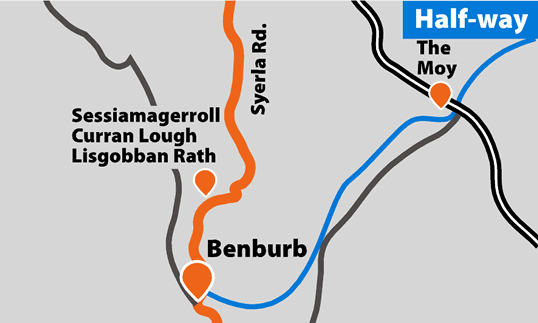
The route follow the NCN (National Cycle Network) signs past the historic landmarks toward Benburb. Curran Lough Crannog, a man made island in the lake to the left, was a defended settlement. Sessiamagerroll Fort outside Benburb, surrounded by seven other raths on nearby hilltops (600-900AD), was used to ‘inaugurate’ or crown Irish chieftains. A wonderful view-point and on a clear day the Mournes, Lough Neagh and Slemish are clearly visible. A few miles beyond we have reached the halfway stop at Benburb. Lunch and refreshments are available in the Priory building.
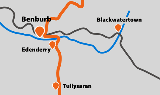
Leave Benburb through the rough forest track to the Blackwater River. Cross the white iron footbridge into Armagh at Maydown Bridge and out toward the village of Tullysarn where the bell tower is a local landmark. The dressed stone was bought from the Charlemont estate when Roxborough House (Moy) was being demolished. The route then goes out through Artasooley, through fiels of orchards and across the rough track over the stream toward Ballytrodden.
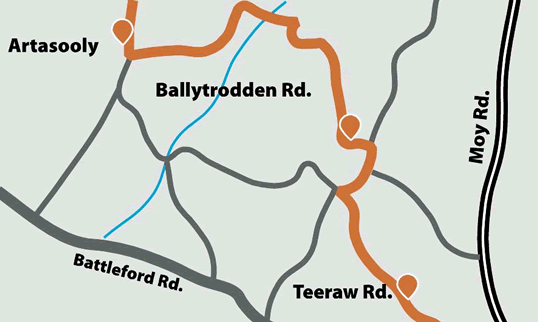
The route now climbs up over the rippling landscape of Ballytrodden where the views stretch out across Armagh, Monaghan and County Down. The finish at Navan Fort is just on the horizon. From here the route goes along Tyra Rd, debate as to the proper spelling means road signs at each end of the road reads “ Tyra” and the other “Teeraw”.
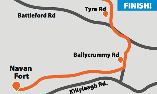
We're only a few miles from the finish now. At the end of Tyra road, cross on to the Ballycrummy Road and left onto the quiet Navan Fort Rd. It's now a short climb over one of Ireland's most ancient landmarks, Navan Fort, and down to the finish at the ground in the Navan Centre.
Route research by Armagh County Museum
